See it in 3D
A stack of wind cells from the surface up to roughly 100,000 ft, colored by speed. Spin, zoom, and pan to study the whole column over real terrain.
Coming soon
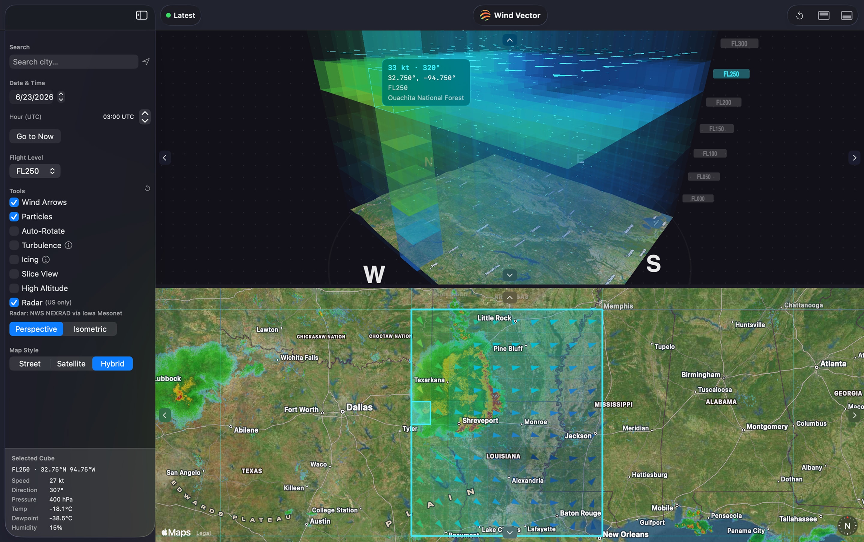
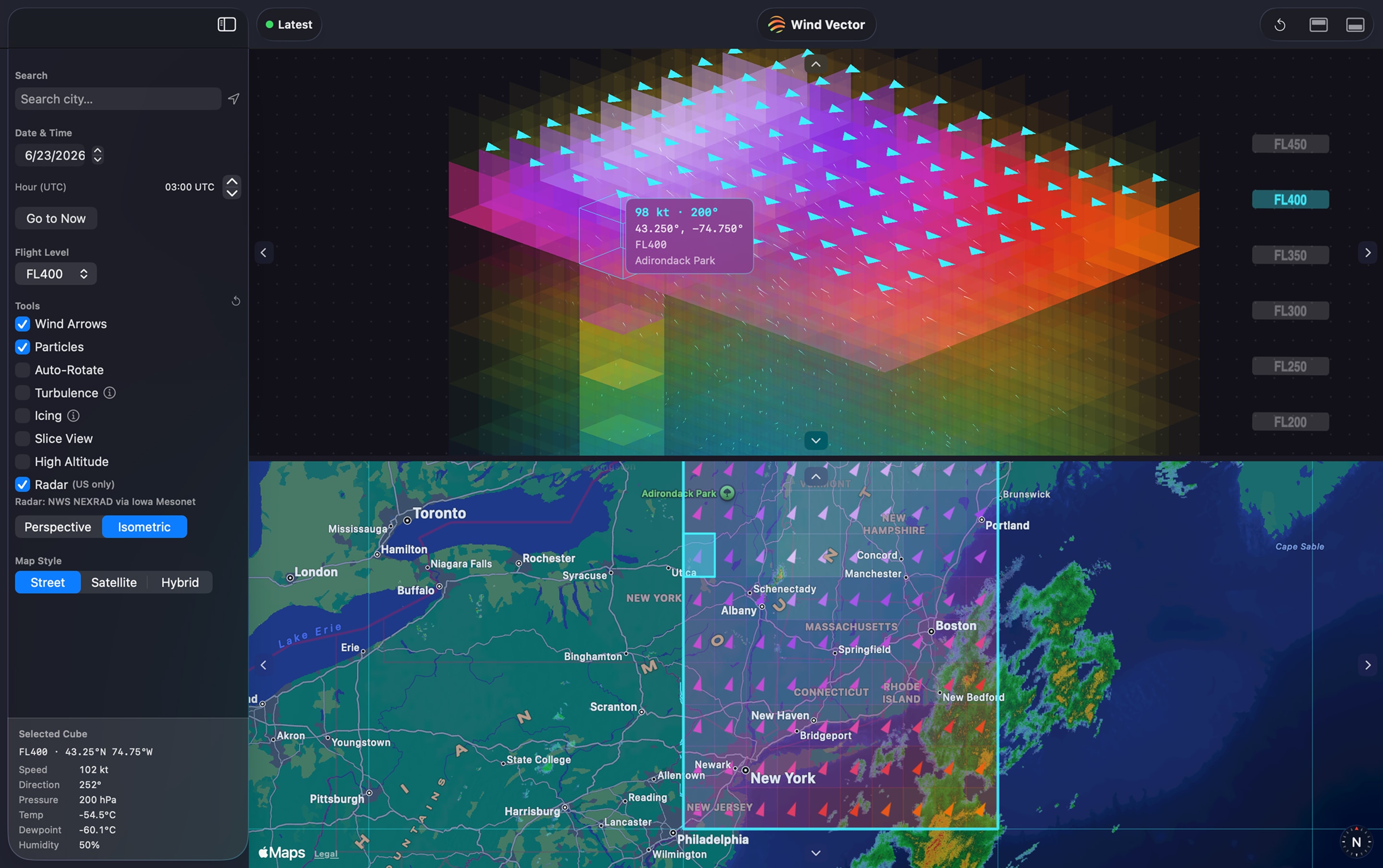
An interactive model of the wind above any place on Earth, sitting right on top of the map. Spin it around, slice it by altitude, and check any flight level in seconds.
A stack of wind cells from the surface up to roughly 100,000 ft, colored by speed. Spin, zoom, and pan to study the whole column over real terrain.
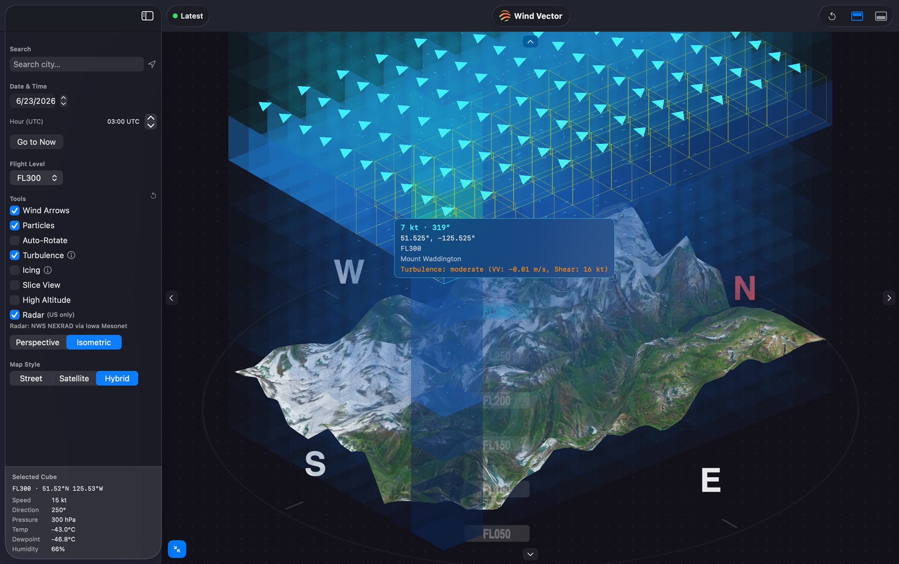
Step through flight levels from FL000 to FL1000, isolate one layer with Slice View, or jump to high altitude. Animated particles and arrows show where the wind is headed.
Turbulence and icing overlays flag rough or icing-prone air, graded by severity. Scrub hour by hour, about a week back and two weeks ahead. (Experimental, informational only.)
A fully native app: SwiftUI, Metal-rendered 3D, and Apple Maps. Real Open-Meteo forecast data from HRRR and GFS. No account, no sign-in.
On the Mac App Store. No account or sign-in required.
Download on the Mac App StoreComing soon to the Mac App Store